|
A total of 6 stages averaging
5.92 miles over a total course length of 35.5 miles.
This is a flat mixed-terrain race using trails, footpaths and
some quiet roads.
Directing marshals (M) and arrows (A)
Post Codes for GPS
Navigation
Paradise Centre, Ely (changing, post-race refreshments,
prizes) CB7 4PQ
Minster Place (start and finish by Ely Cathedral)
CB7 4EL
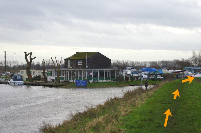
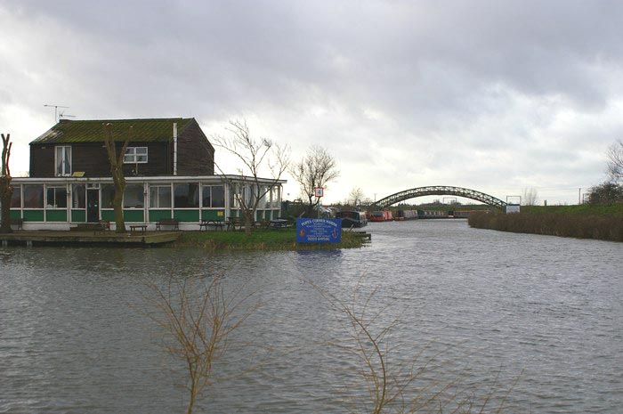
Stages 1-2 changeover at Dimmock's Cote
CB7 5XL
Stages 2-3 and 4-5 changeovers at Waterbeach
CB5 9HZ
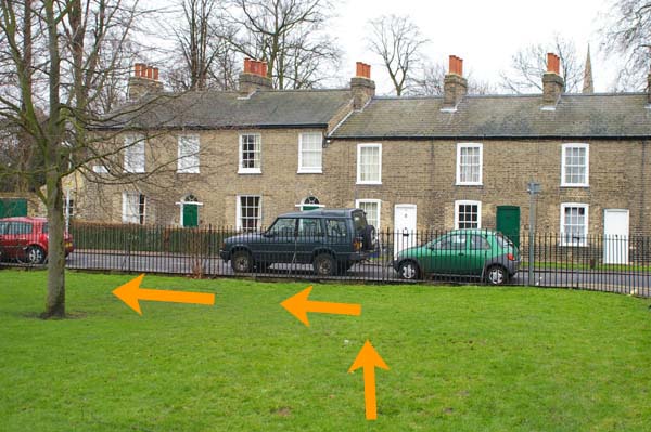
Stages 3-4 changeover at La Mimosa Restaurant, Jesus
Green CB5 8AQ
Stages 5-6 changeover at Upware car
park CB7 5ZR
| Stage 1: Ely - Dimmock's Cote
(5.6m
miles - minimum age 16)
MAP
|
|
|
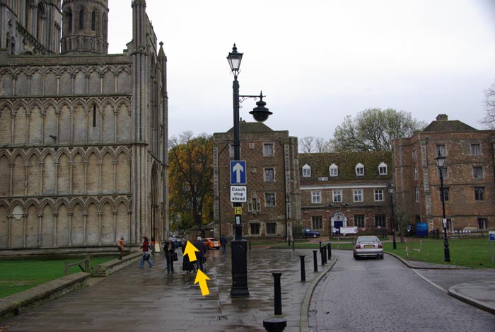
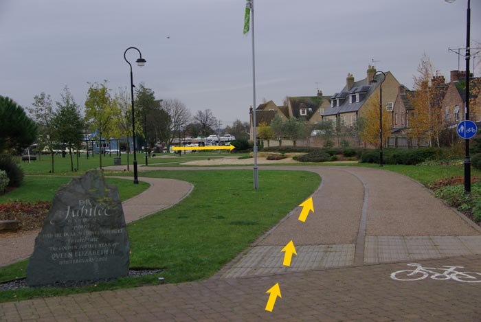
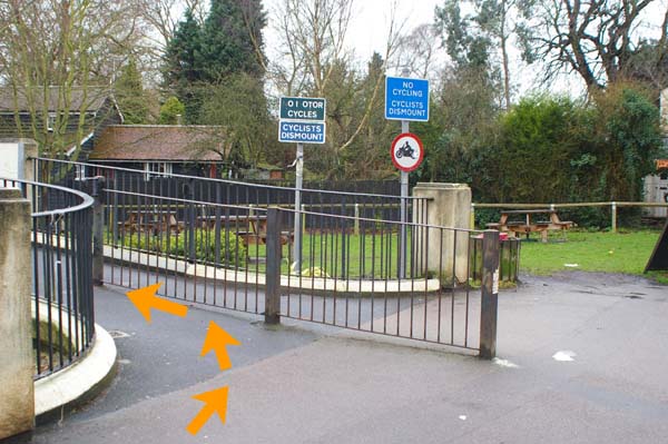
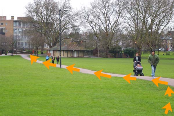
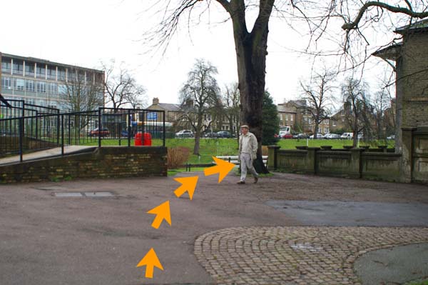
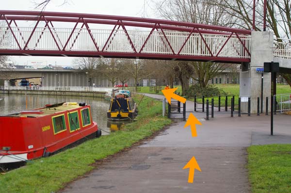
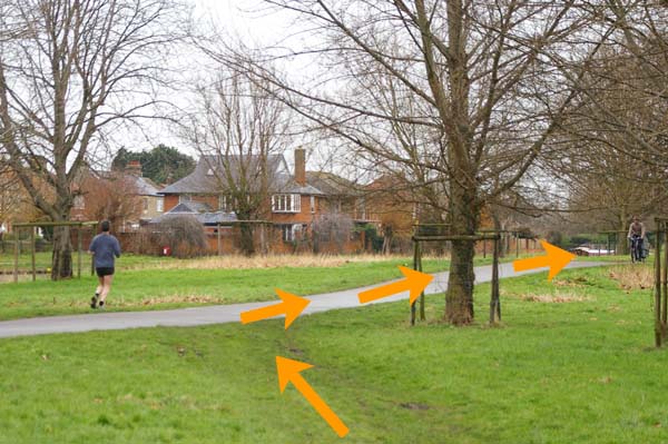
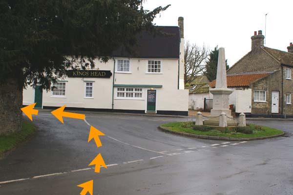
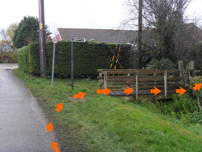
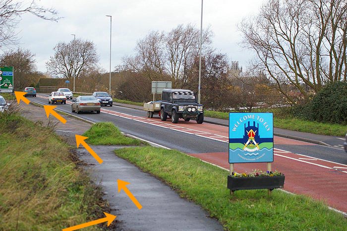
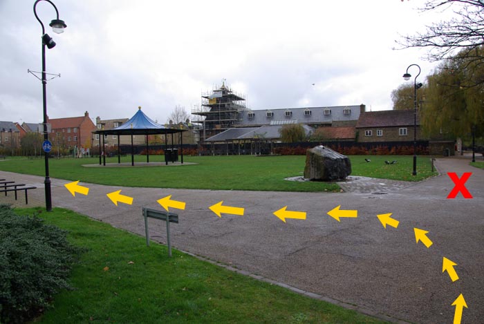
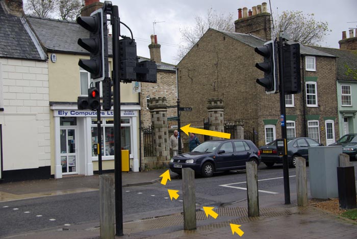
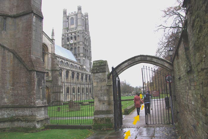
Start
in Minster Place by tall lamppost near to the west gate of Ely
Cathedral. Run down The Gallery and
left (M) through The
Porter (M) onto footpath down hill
through The Park to
cross
Broad Street (M) into
Jubilee Gardens to the river bank (M)
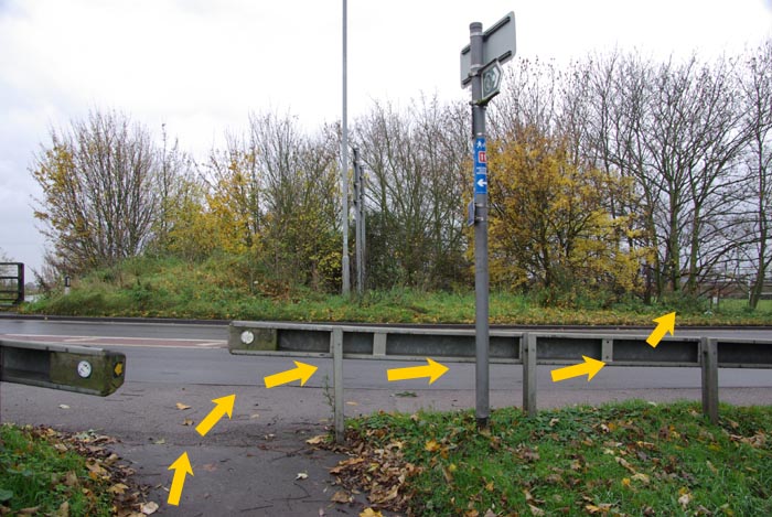
and turn right past The Cutter Inn. Follow riverside tarmac
path to cross A142 (M) onto the
track (M) along the west side
of the R Gt Ouse to
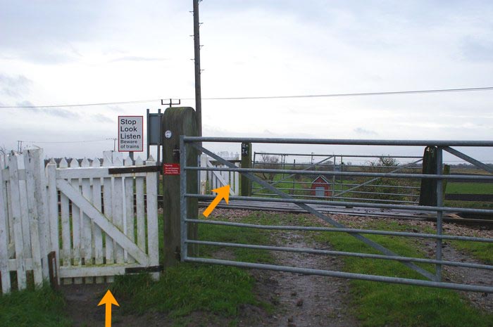
single line (M) level
crossing (1.6m). The vehicle access gates will be open and
there should not be any trains - but stop if requested
by the marshal. Failure to obey the
marshal will result in disqualification of the stage runner
and team.
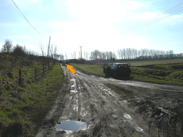
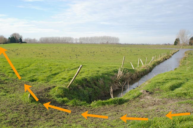
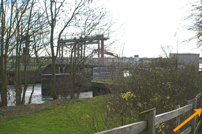
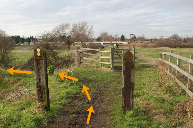
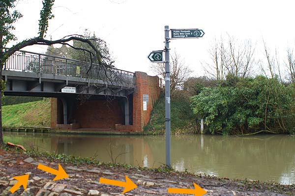
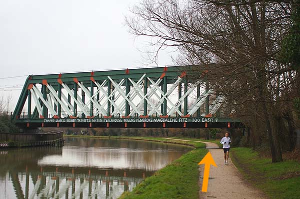
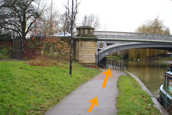
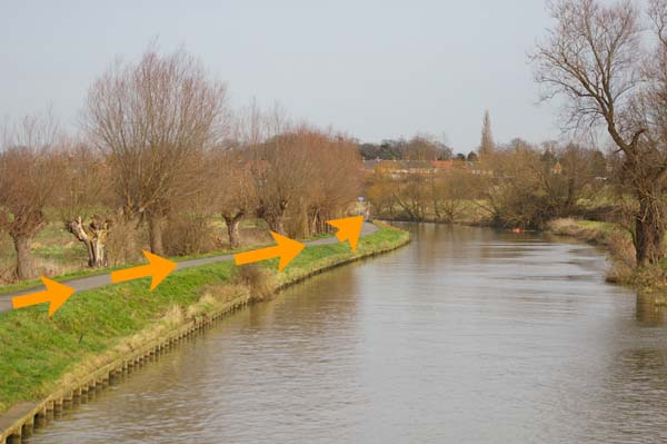
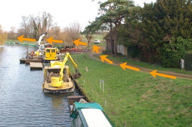
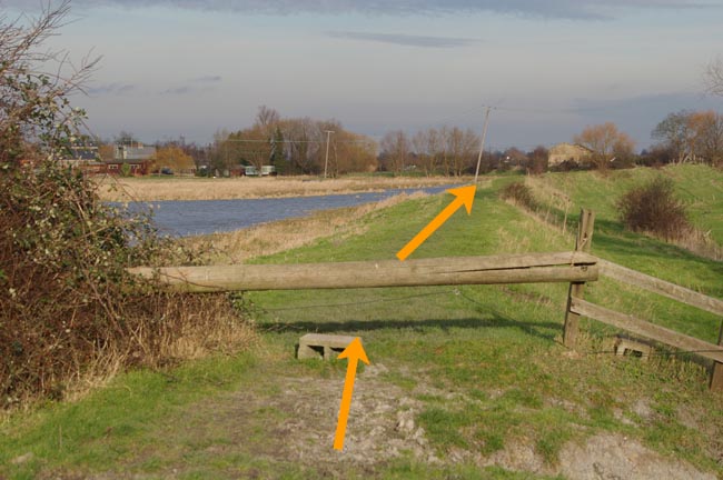
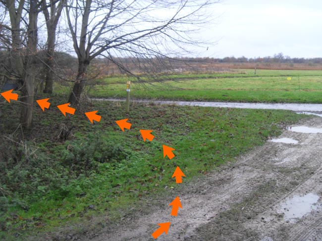
Continue 0.6m to cross Braham Dock (2.2m)
inlet using
the new footbridge (A)
continue
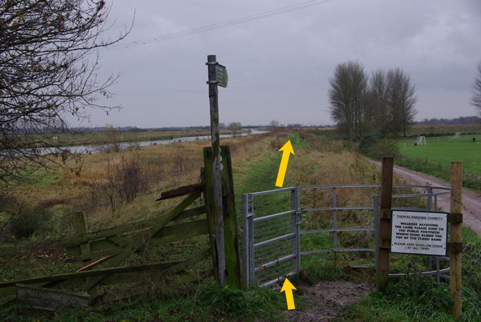
along riverbank 1.1m to two K gates (A) near Lt Thetford and
remain on riverbank for 0.7m to footbridge (M) over R Gt Ouse
at the
Fish & Duck marina (4.1m). After
bridge (M), turn right (A)
for about 20 yards and then left (A) to join R Cam riverbank
(A) and follow for 1.6m to Dimmock's Cote where there are
two changeover options (WET & DRY), depending on
conditions:
WET - carefully cross A1123, as directed by marshals,
down track for 80 yards to the changeover on grassy
verge on right, just beyond the junction with
the car park track.
DRY - on approaching Dimmock's Cote, bear left
(signed) off the raised riverbank across the water meadow and
under the A1123 concrete road bridge to the
changeover just beyond.
| Stage 2:
Dimmock's Cote -
Waterbeach
(6.1 miles - minimum age 16)
MAP
|
|
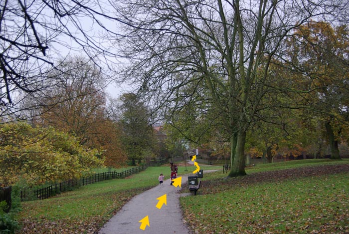
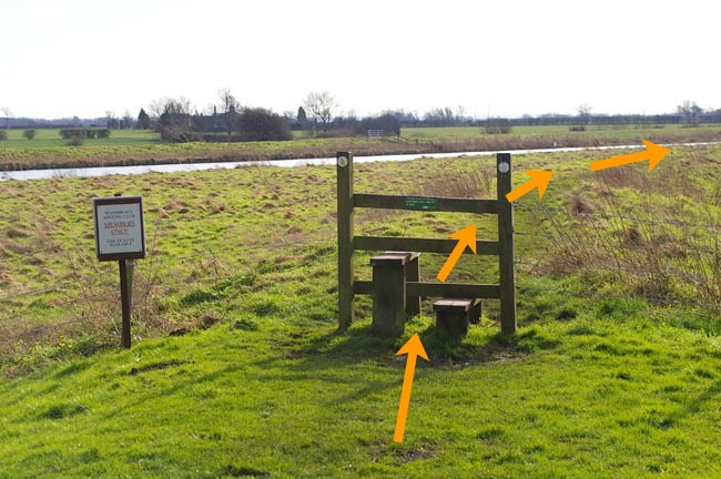
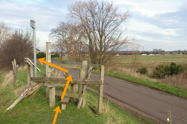
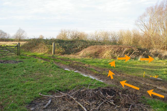
Follow raised bank path to another
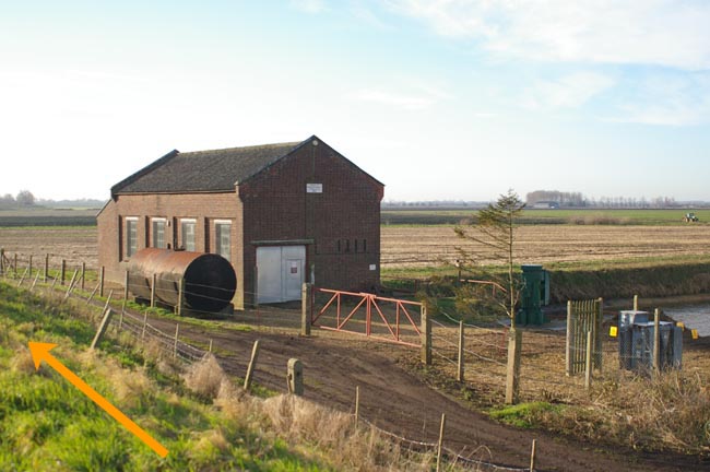
K gate (0.3m) to
pump house (0.5m)
on right and
concrete pillbox on left. Continue along raised
bank path and see
Upware Marina (1.3m) on other side of river.
Continue to
track junction (1.7m). Turn left at style (A) down
to gate and riverside meadow. Continue along meadow past
1st
water channel (2.1m) on right (A). Continue to
style (2.4m)
across meadow fence (A). Continue to
2nd water
channel (2.7m) on right and head diagonally (A) right to
K
gate (2.9m) on raised bank path at end of meadow (A). Follow
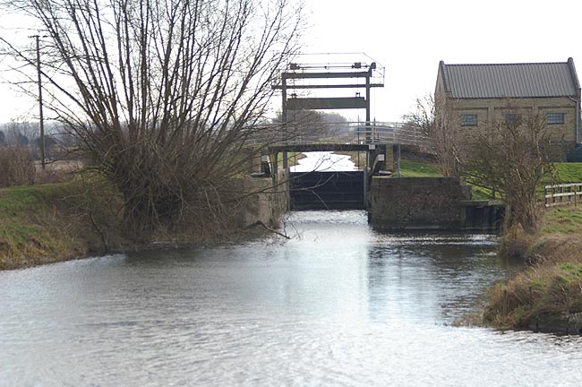
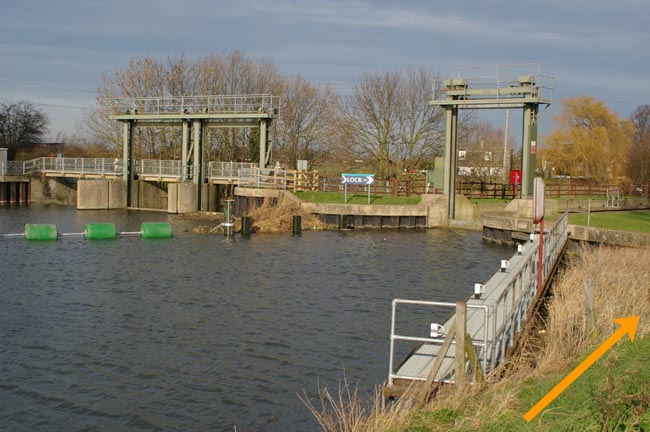
along raised bank path and
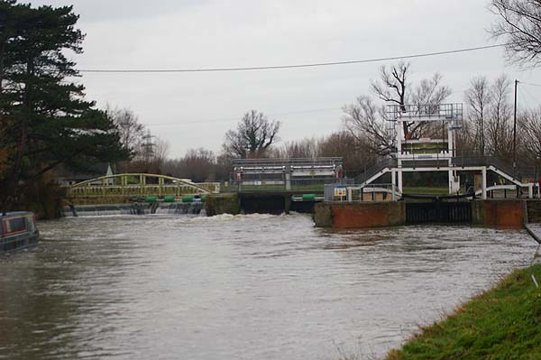
see lock (3.6m) on other side of
river. Continue along raised bank through
K gate (4m) and
K
gate (4.6m) to gate just before weir (5m) with
island lock on
left. Ignore path across weir and continue straight ahead (A)
through another gate (A) and
along raised bank path across
style (5.1m)
and another
style
(5.3m) until through
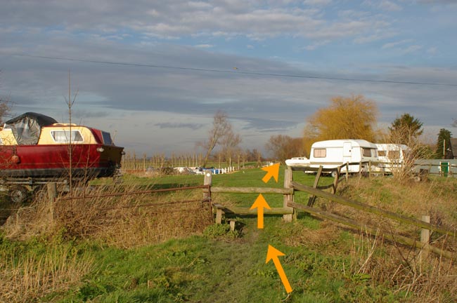
gate (5.6m)
with mobile home park on
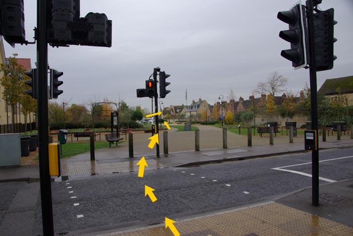
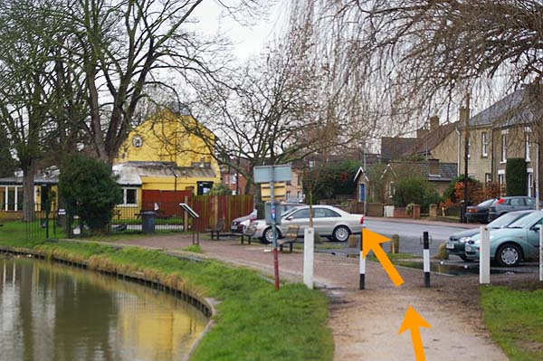
left. Continue on footpath to
track junction (5.7m) and take
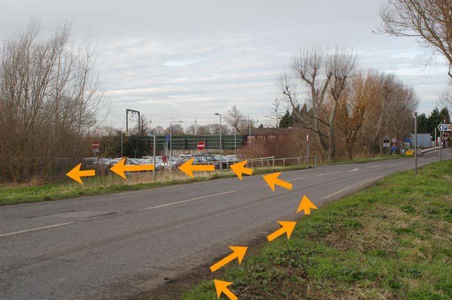
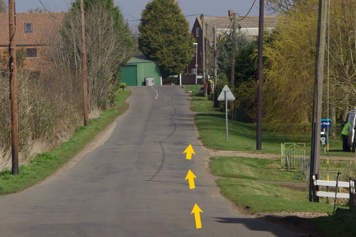
left turn (A) to road (5.8m). Take staggered right (M) and
left (M) across road to
cycle track and turn left (A). Follow
cycle track (parallel to road) to end of stage (6.1m) in
lay-by from corner of road opposite Bridge Pub car
park. Note: this lay-by is for official’s cars only
and please do not use pub car park.
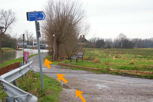
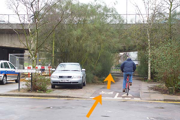
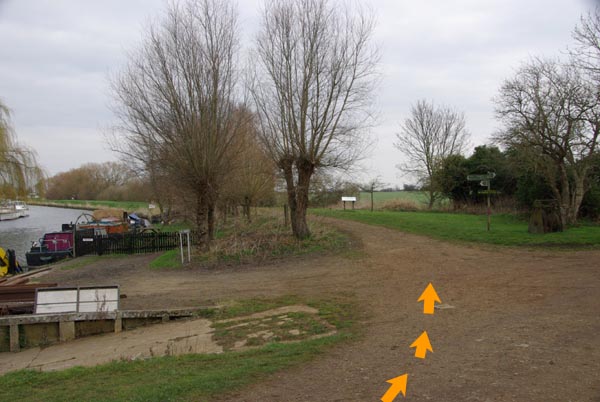
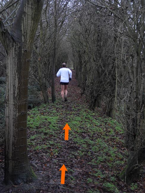
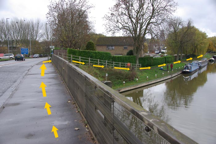
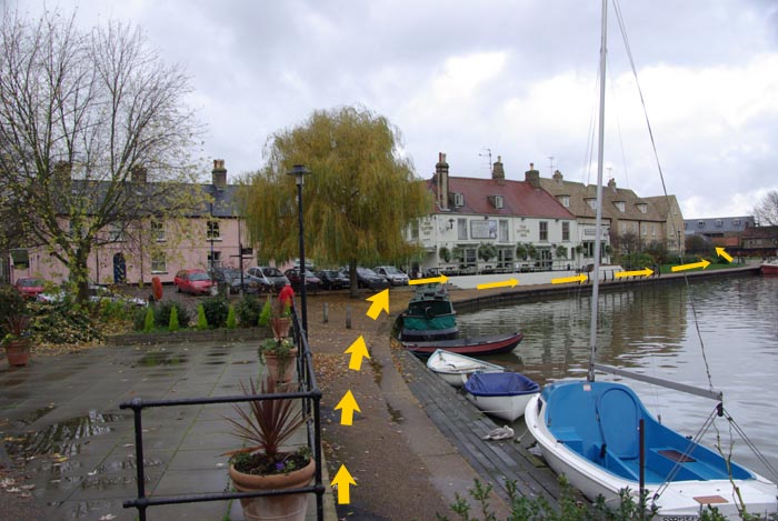
| Stage 3: Waterbeach -
Cambridge
(5.7 miles -
minimum age 15)
MAP
|
|
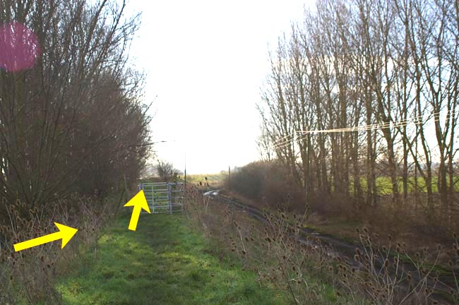
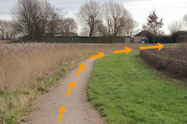
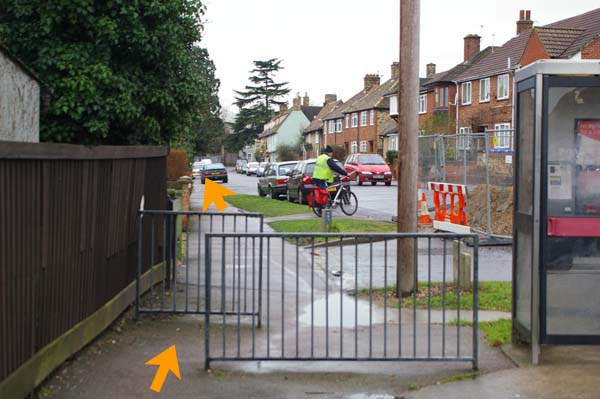
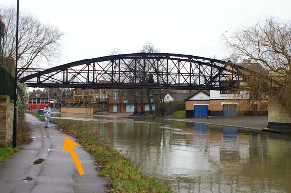
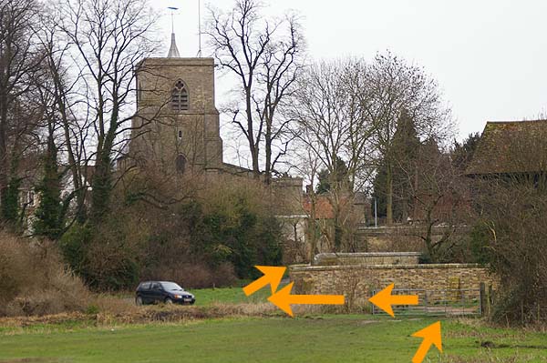
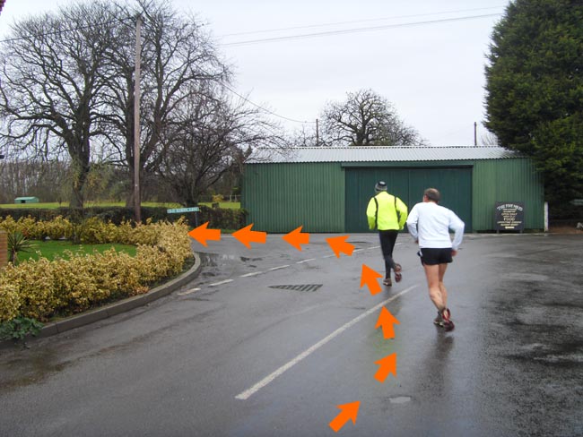
After
take-over (near lay-by opposite the Bridge pub’s car
park) follow cycle path for 100 yards to the
riverside cycle
path and turn right (M) alongside the R Cam towards Cambridge.
Follow this path (river on left)
past an access road (A) from
Milton on right (1.8m), then
Baits Bite Lock (2.0m) on left,
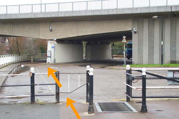
and continue (A) under A14
dual carriageway bridge (2.3m) and
under railway bridge (3.6m) until the riverside path
joins (A)
Water Street in the same direction (M) just before the
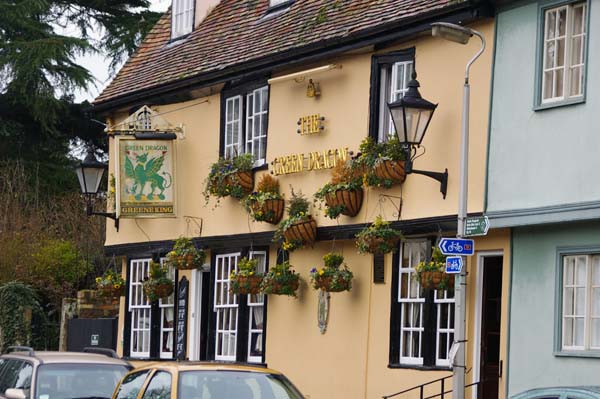
Penny Ferry pub (3.9m). Keep to left pavement (pub on
left) of Water Street for 370 yards and see
Green Dragon
pub on right. Opposite this pub
turn left (A) across
footbridge (4.1m)
across river and then
right (M) along
riverside footpath (A) with the river now on right. Continue
to where joins (M) Riverside road (4.3m) and go past
pumping
station (4.5m) with a tall chimney to the (M)
Elizabeth Way
bridge (4.7m). Continue straight ahead under Elizabeth Way
bridge (A) and along the riverside footpath under red and
white footbridge (4.9m) past Midsummer Common (on left) and
under (A) black
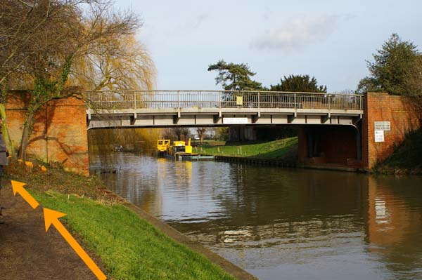
footbridge (5.2m), and then under (A)
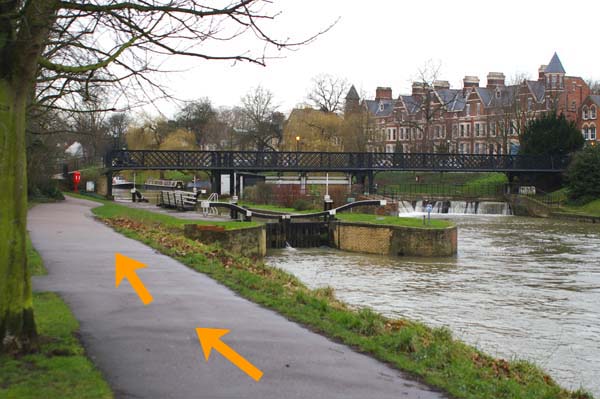
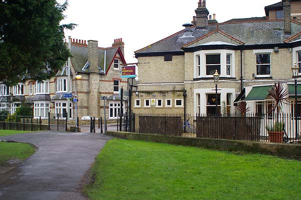
Victoria Avenue bridge (5.3m) to Jesus Green. Follow (A)
the riverside footpath past the swimming pool on the left and
lock (5.5m) on the right (M) and continue to the end of stage
(5.7m) by La Mimosa restaurant
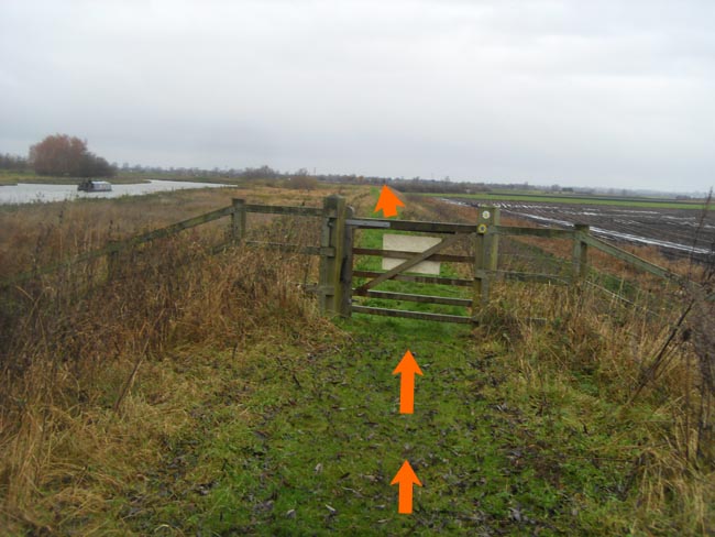
| Stage 5: Waterbeach -
Upware
(4.5
miles - minimum age
16)
MAP
|
|
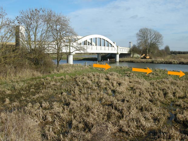
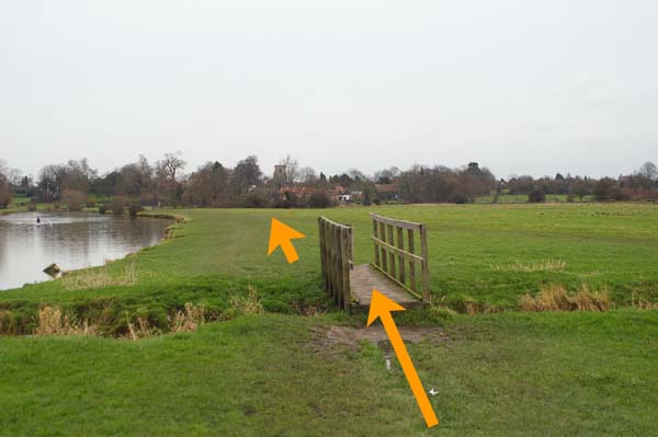
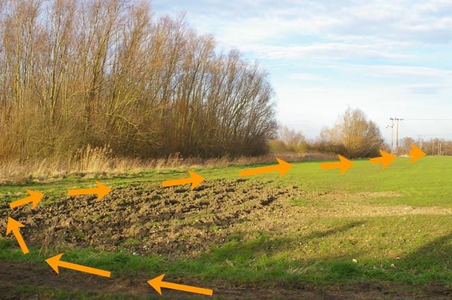
After
take-over follow
riverside footpath that becomes a raised bank path. Ignore
left turn across lock and weir (0.9m) and continue (A) to cross
Bottisham Lode (1.0m) along (A) raised bank path through
K
gate (1.9m) to Lode Farm and lock bridge across
Swaffham Bulbeck
Lode (2.3m). Follow (A) raised bank path
across style (A)
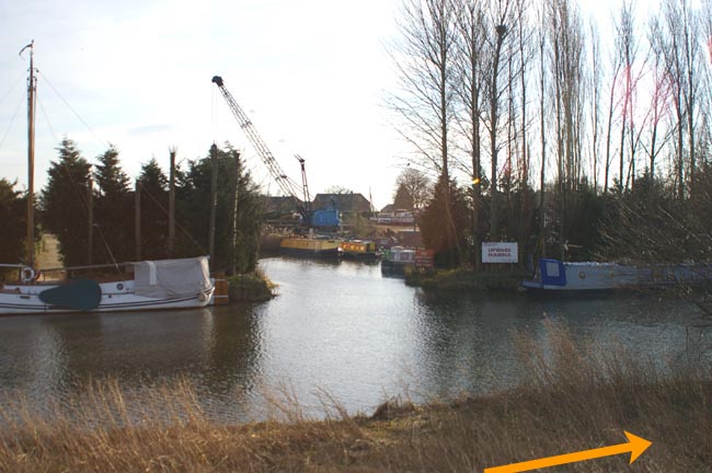
to/through marina (A) and
though K gate and
over pole barrier
until joins (M) road (4.3m).
Continue
ahead along road across Upware lock bridge and straight on for
120 yards to changeover at car park
on right (4.5m).
Note:
If using the same vehicle, fast teams will not have enough
safe time to collect their stage 4 runner and deliver their
stage 5 runner.
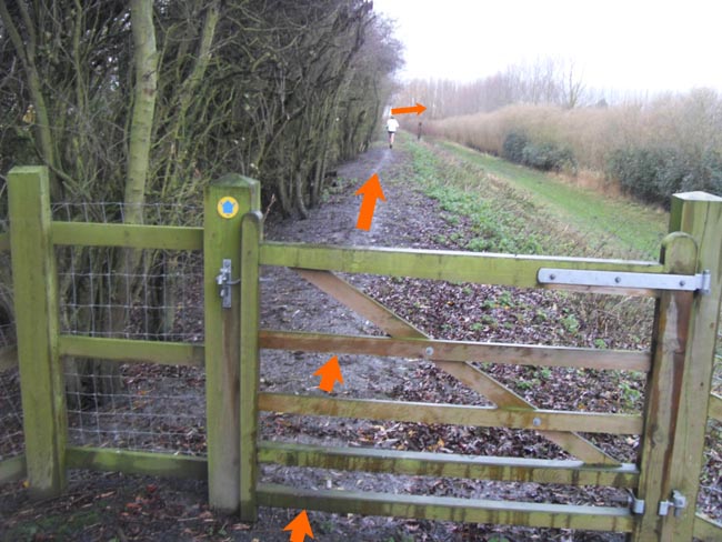
| Stage 6:
Upware
- Ely
(7.6 miles - minimum
age 17)
MAP
|
|
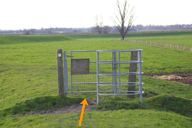
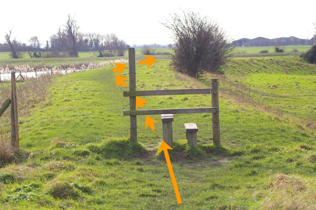
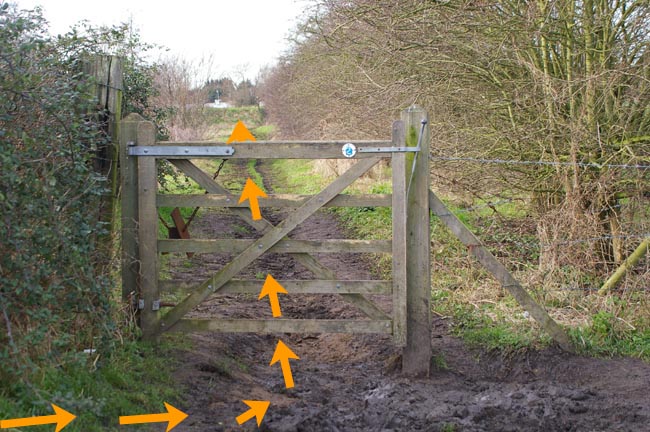
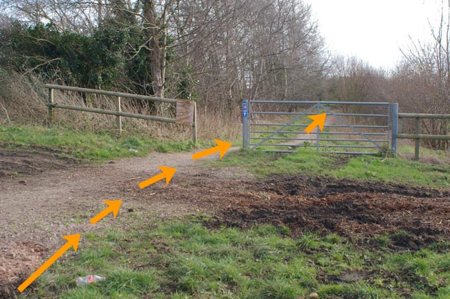
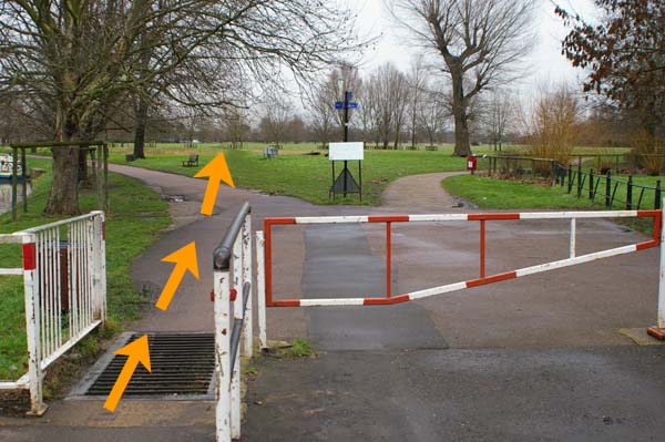
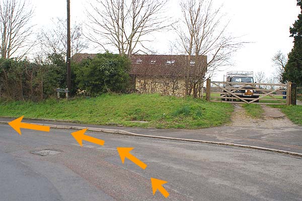
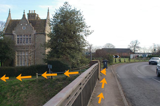
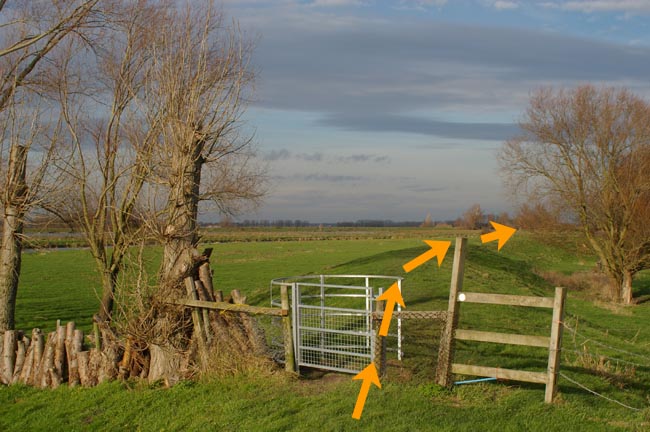
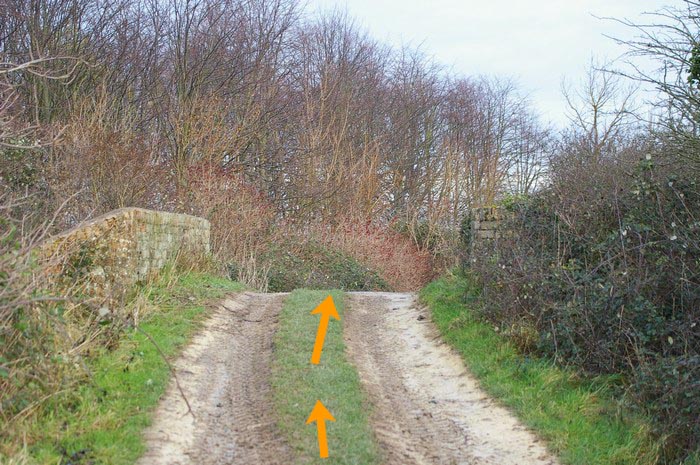
After
take-over, go 170 yards to T-junction and turn left. After 110
yards (at sign post ‘Public Footpath to Ely 7.5m’)
turn
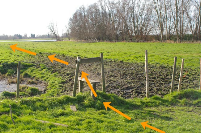
right (A) over style to path across small meadow to another
style.
Cross style and turn left (A)
to base of arable field.
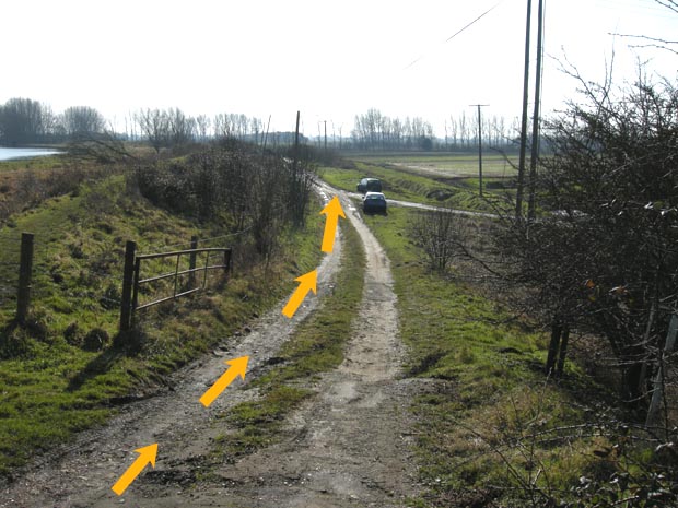
Ignore track through gate (A) and
turn right (0.3m) along soft
track at base of cereal field and right again (A) alongside
wood. At end of wood (0.7m) turn sharp left (M) along grassy
track which becomes very muddy before crossing (M) the
A1123
(1.6m) to continue along track (with Chalk Pit works on right)
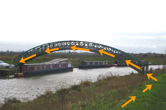
for 0.4 mile to Kingfisher (humpback) bridge
(2.0m)
and after
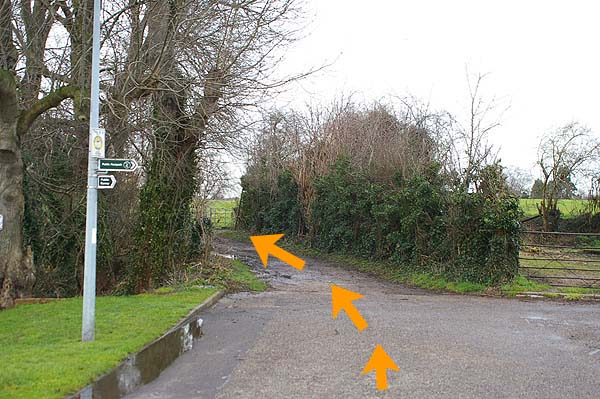
80 yards turn left (M), just before T-junction
with concrete
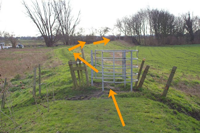
road, onto raised bank public footpath. Follow raised bank
through the trees and a gate (A) and around right hand bend. After the trees,
the river can be seen on your left (2.7m) and ahead
see Ely Cathedral
in the distance. Follow raised riverbank path until see
Fish & Duck marina and Rs Cam/Gt Ouse confluence on
other side of river (3.5m).
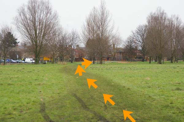
Continue
along raised bank path to and over (M)
Lode End Bridge/pump house
(4.7m) and
continue ahead (A) on top of R Gt Ouse bank until bank
top
path changes to tarmac surface (5.0m).
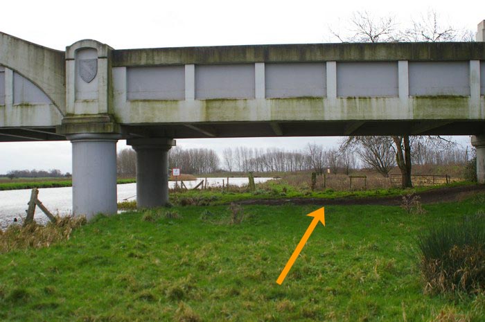
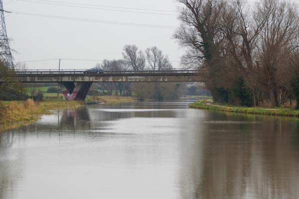
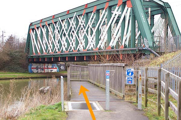
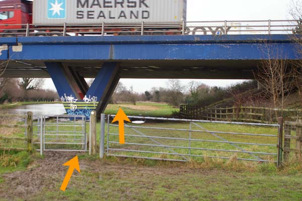
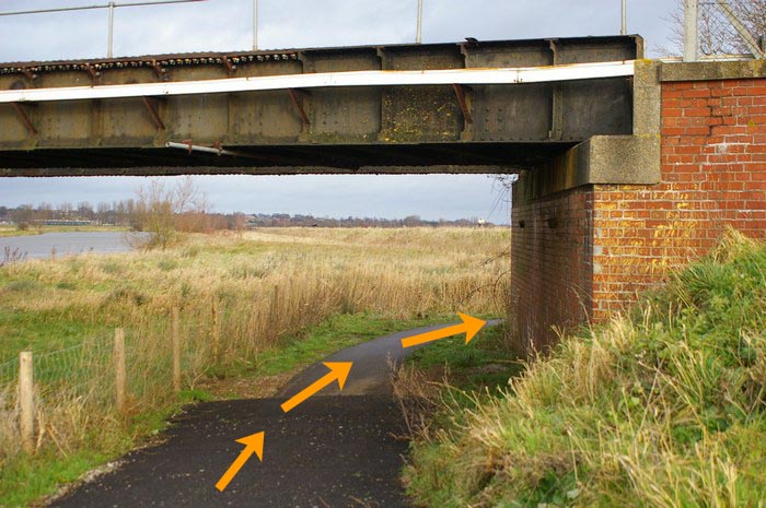
Follow
tarmac riverside path
under the new railway bridge
(M)
(5.8m). Do not use the level crossing. To do so will result
in disqualification of the stage runner and team. Continue
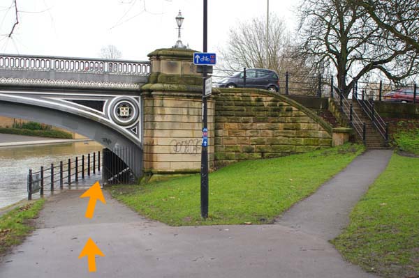
along tarmac path to the
A142 (6.5m) where
turn left
and shortly cross road (M) to pavement and continue across
river bridge. Immediately
after the river bridge, turn right
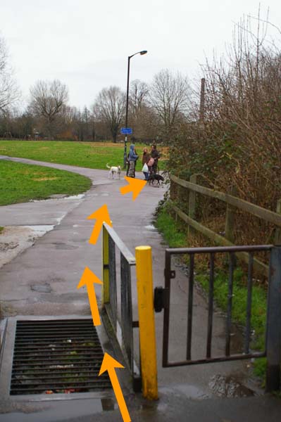
(A) down riverside footpath and follow under railway bridge to
The Cutter Inn (6.9m) on your left. Stay on riverside footpath
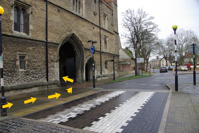
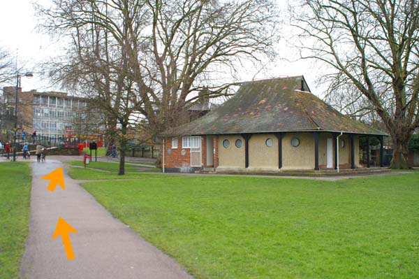
and after 70 yards, turn left into Jubilee Gardens and
across
Broad Street (M) at the pedestrian crossing into The Park.
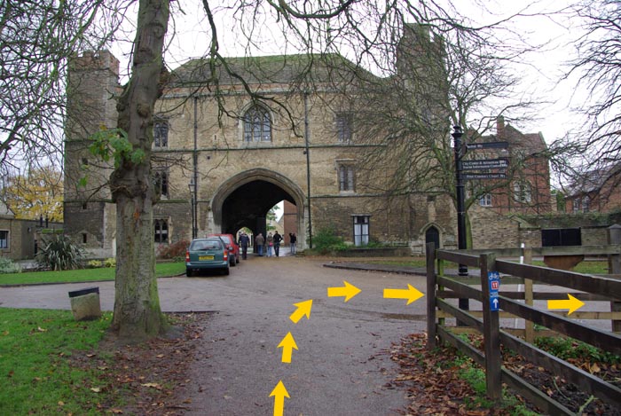
Follow the footpath up through The Park and turn right (M) at
the top (before The Porta) onto the access road towards
Ely Cathedral. Follow this road (which becomes a
wide
footpath) around the back (east end) of the cathedral and
along the north side of the cathedral to the Finish (7.6m) on
the grass area between the cathedral and High Street.
|